OpenStreetMap & StreetComplete
Posted on December 3, 2023 • 4 minutes • 760 words • Other languages: Français
In my spare time, I contribute to OpenStreetMap and am regularly asked the following question: What is OpenStreetMap?
Family, friends, colleagues, readers, here’s a quick introduction to one of the biggest collaborative projects 🗺.
What is OpenStreetMap (OSM) ?
OpenStreetMap is a global and collaborative project for free mapping, born in 2004 and supported by the OpenStreetMap Foundation . Anyone can view, edit and modify the map.
OpenStreetMap is above all a database containing all the cartographic information that contributors add to it (GPS data, imagery, cadastres…). Every week, you can even download the latest world map to your PC here ! 133GB at the time of writing 😲
The visualization of this data is then done by maps that integrate them and display what they want. The amount of information contained in OpenStreetMap is immense and the level of detail is gigantic, making it the most complete mapping system in the world!
The official site containing the database and allowing you to contribute by creating an account is : openstreetmap.org
On openstreetmap.org you’ll also find a map (“a rendering “), i.e. a arbitrary graphical representation of certain information contained in the OSM database.
Once you’ve understood that OpenStreetMap is a cartographic database, you might well ask : what’s the point of all this data ?
What’s OpenStreetMap for?
From the simple location map displayed on a web page, to the use of data in smartphone applications, web services, navigation software and humanitarian cartography, OpenStreetMap has a wide variety of uses.
A map is a representation of the OpenStreetMap database. If all OSM data were on a single map at the same time, the map would be unreadable, which is why there are a multitude of different cartographies that are linked to different uses:
- general usage (OSM , Openroute … )
- navigation (bike, hike, car, various routes…)
- humanitarian
- reduced mobility
- history
- 3D
- video surveillance
- relief
- skiing
- cycling
- trains
- seas and oceans
- infrastructures (electrical, hydraulic…)
- OSM collaboration in the form of challenges
- emergency mapping following a humanitarian disaster
- SNCF trains live in France
For your smartphone, I recommend 3 applications that I know well:
- OSMAnd : very (too?) feature-rich, it takes a while to learn, but it’s ultra-complete, powerful and high-performance! (You also need to have some storage available on your phone).
- Organic Maps : excellent for everyday use or hiking, it consumes no battery power, I use it as a complement to OsmAnd.
- MagicEarth : I’m currently testing it for car navigation.
How do I contribute?
To contribute, start by creating an account on openstreetmap.org , which will enable you to make modifications to the world map.
Then, there are several ways to contribute with your OSM account. I’ll mention three methods (not exhaustive):
- 🟩 beginner level:
- Via the StreetComplete application on Smartphone (see below)
- 🟨 Advanced level:
- Via your browser through OSM iD
- 🟧 Expert level:
- Via dedicated software such as JOSM
I discovered StreetComplete at the equivalent of a cartoparty in March 2023, and I’m going to tell you a little more about this excellent application.
StreetComplete
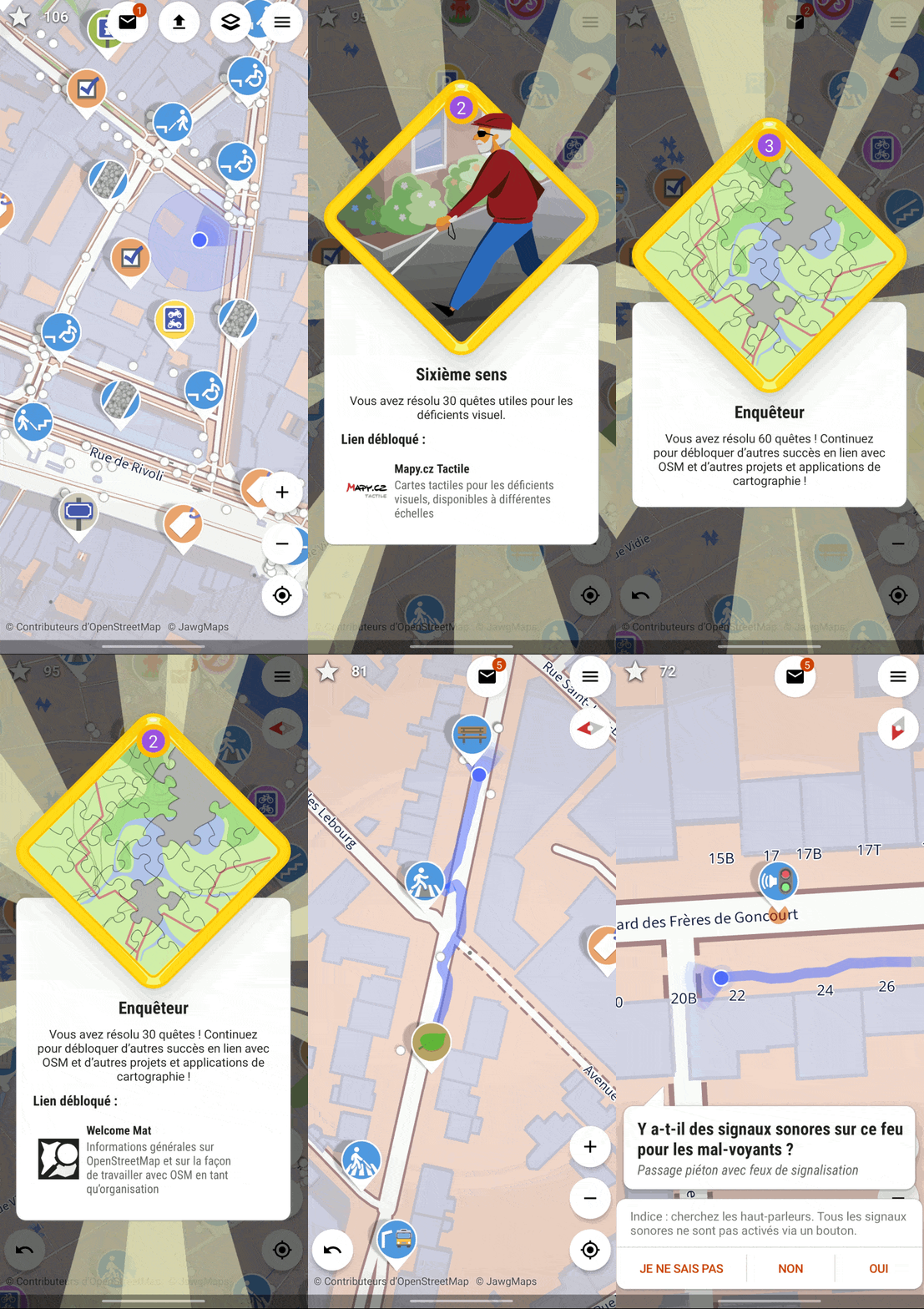
StreetComplete is a Android application (only ) that recognizes and displays information around you that needs completing or improving. It simply requires an openstreetmap account as seen previously in my article.
The map features markers in the form of icons and you can set the quests/tasks you wish to perform. For example, you may decide to work only on improving information about pedestrian crossings. In this example of a quest, the information you gather will subsequently help visually impaired people who use dedicated applications, or connected devices that help them get around or plan their routes.
Remember that you can concentrate on the quests that interest you, there are currently 161 in the app, plenty to keep you busy 👍
StreetComplete is great fun and makes it easy to help and contribute. It encourages you to walk around and discover your neighborhood, your city, your country. I love it because it allows you to discover all kinds of things in the city, to pass through places you’d never have been before, to discover the architecture, the stores, to realize how adapted or not certain neighborhoods are for people with reduced mobility.
Enabling everyone to contribute to the free, to the commons, through collaborative cartography, is a fully successful mission for StreetComplete 👏 !.

Exchange, meet, learn
Regularly throughout the world, you’ll find “cartoparty” workshops where you can meet, share, map with contributors from your neighborhood, your city, your region.
🌎 Don’t wait any longer and join the worldwide OpenStreetMap adventure! 🌎
